Earth Observation
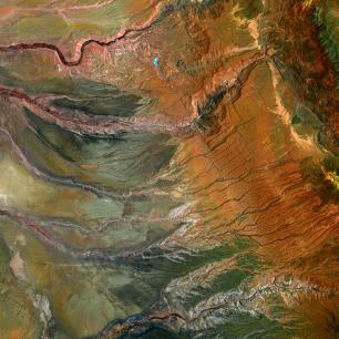
Remote sensing and geographic information systems (GIS) have made it possible to analyze the territory at both global and detailed scales. These analyzes are essential for making decisions about the sustainable management of natural resources, designing networks of protected areas and facing the threats of global change.
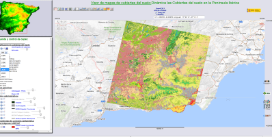
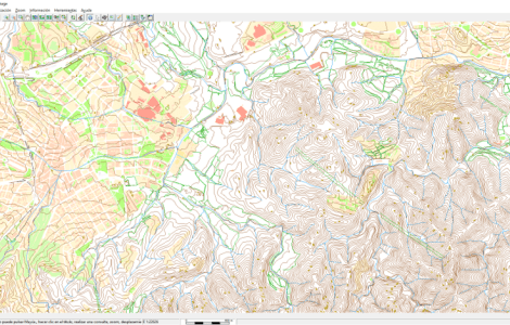
Thanks to the research carried out by CREAF in this area, we have made available to the public a set of digital land cover maps for various periods, designed new formats for storing and distributing thematic cartography, and developed computer tools such as the GIS MiraMon, which allows you to consult and analyze large volumes of information about our natural heritage, facilitating the interoperability of data and promoting open standards.
Our contributions also support the implementation of the Sustainable Development Goals (SDGs) and the 2030 Agenda, as well as the integration into the spatial data infrastructure through advanced remote sensing techniques and satellite imagery.
Focus areas
- Geospatial products and international standards
- Long term ecosystem monitoring
- GIS and remote sensing methodologies and applications
- Regional and global environmental information services
The consolidation of interconnectivity in the global network has been possible thanks to the adoption of international standards. Environmental data is not an exception to this phenomenon, but its geospatial component requires new ways of visualizing, processing and transporting information. The integrated usage of data from different origins is only possible through international agreements that allow rapid consensual adoption of recent technological innovations. In this process experts from around the world and involved. They analyze the new requirements and formulate open solutions that all actors can freely adopt. This way, the development of environmental spatial data infrastructures at the European level (INSPIRE) or globally (Global Earth Observation System of Systems) is possible. They serve in the creation of knowledge about global change and the impacts of human societies that are useful for the decisions making.
CREAF contributes to this discipline in two ways: On the one hand, it brings its knowledge, sometimes leading the creation or revision of international standards. On the other hand, it releases cutting-edge and high efficiency technological implementations. It also advises and contributes to their deployment, both in the research and academic world, as well as in the public administration and private sector. CREAF is a reference in standardization and contributes this knowledge to complement research and innovation projects of national, European and global scope. In particular, the work on geospatial standards is carried out by the Research Group on Remote Sensing and Geographic Information Systems (GRUMETS).
The main lines of work and experience of CREAF in this field include:
- Leadership in the creation of international standards: Creating and reviewing geospatial standards for data visualization (WMS, WMTS), encoding (GeoJSON), download of data (WCS, GMLJP2), data documentation (Geospatial User Feedback), and preservation and packaging of data and metadata (ISO 19165, MMZX). Active participation in international organizations such as the Open Geospatial Consortium.
- Implementation and adoption of standards: Implementation of applications and practices that increase interoperability among research environments in biodiversity, ecosystems, water, citizen science, administration, etc.
- Creation of interoperable products and technologies: Remote Sensing tools and distributed Geographical Information Systems incorporate the latest international standards and serve as pilot programs for the adoption of new standards candidates.
- Data quality: CREAF maintains a quality measures vocabulary (QualityML) and promotes the correct documentation of the data quality, lineage and usage of data products and services.
- Viewing services, downloading data: The data produced by CREAF or the projects in which it participates is made available through interoperable servers and map portals.
- Web sensors, distributed processing and data modeling for automatic generation of knowledge: Research is done on the management of automatic sensor data and the automatic processing of data to assist in the knowledge creation process.
- Data management and preservation: CREAF pilots and refines innovative data management and preservation policies and principles based on international standards and performs data management and migration to ensure its preservation.
What have we done?
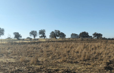
Ecosystem dynamics encompass the participation of many species with different life cycle lengths, from a few hours to tens of years. One possible line of research is to dissect some key processes involved in the overall dynamics and extract general rules. This type of data can be combined in simulations in order to make predictions about the future dynamics of these systems in the medium and long term. However, as more processes are combined, prediction becomes more difficult. Difficulty also increases if an ecosystem is undergoing environmental change including contemporary global change and associated predictions on a regional scale. For this reason, a more holistic complement to research is based on monitoring the dynamics of the ecosystem through observation and characterization. The objectives of monitoring are to diagnose what may be occurring ecologically in a given place, compare specific regions with planetary-scale data, predict short term trends, and feed and validate models designed to understand and reproduce dynamics in the medium and long term.
The main lines of work and experience of CREAF in this field include:
- Atmospheric deposition: We analyze the chemical composition of atmospheric deposition and its effect on terrestrial and aquatic ecosystems. Using deposition collectors and analysis of water in soils, streams, and ponds, we assess the effects of long-term atmospheric deposition at sites of particular interest (e.g., Montseny, Pyrenees).
- Animal populations: We run an program which evaluates and measures oscillations of mammal populations (e.g., marmot, boar) which is followed up with long-term monitoring.
- Species distribution and phenology: We design, coordinate and execute monitoring programs for organism groups which are of particular value as indicators (e.g., birds, butterflies, or plants associated with alpine cols).
- Aquatic microorganisms: Aquatic microorganisms respond rapidly to environmental fluctuations, so studies in remote areas allow the monitoring of regional manifestations of global change.
- Natural records: We interpret and calibrate long term paleoecological records. There are records of the natural dynamics of the past (e.g., tree rings, sediment ponds, peat) whose interpretation can be improved if they are paired with different kinds of measurements made by instruments over a number of years.
- Forest ecosystems: We carry out long term forest monitoring within the context of repeated forest inventories or targeted programs for monitoring forest health.
- Monitoring indicators for communities and habitats: We carry out monitoring in order to understand the dynamics of the composition and structure of communities of organisms and their habitats, and we develop indicators to evaluate and propose appropriate management strategies.
- Simulation of conditions of climate change: We carry out monitoring of experimental plots in ecosystems such as scrubland where we simulate conditions of aridity and warming and measure how the characteristics of the ecosystem change in the medium and long term.
What have we done?
Remote sensing provides us with a continuous and constant source of information about the Earth, and geographic information systems (GIS) are a methodology for handling all of this geographic data. The marriage of the two disciplines has allowed us to carry out large scale analyses of the Earth's surface and, at the same time, provide increasingly detailed knowledge on many planetary variables and improve our understanding of its functioning. These analyses are essential for decision-making on the sustainable management of natural resources, designing networks of protected areas, and addressing the threats of global change.
Broadly speaking, geographical information would not be so useful without validation and knowledge about measurement accuracies, documentation of its quality, and a capacity to deal with any errors that arise. It is in this particular area, within the research line of GIS and remote sensing methods and applications, that CREAF has the highest degree of expertise. This work is carried out by the Research Group on Methods and Applications in Remote Sensing and Geographic Information Systems (GRUMETS).
Data quality and uncertainty: We study the spatial distribution of uncertainty in categorical maps. We also test approaches for the visualization of uncertainty as a support tool for decision-making. Finally, we incorporate quality parameters in metadata documentation.
International standards: We contribute to the field of internet mapping and distributed geoservices provided by the OGC, and we also participate in the implementation of international geographic data standards (ISO).
Advanced image processing: We carry out parallel computing and massive data processing for the Big Data era.
Theoretical and methodological studies in GIS: We do research in the field of the data interpolation which is needed for geodesic calculations implemented in GIS tools. We also study datum transformations and their implications.
Applications in GIS and remote sensing: We have created land-cover maps, and we study landscape dynamics and ecology, including global change.
What have we done?
Environmental research and management are linked to the data we obtain from the natural and social spheres. The multidisciplinary nature of this subject makes these data very complex, especially when dealing with the interaction between the natural environment and society. On the other hand, some time has passed since the capacity for data collection has increased exponentially, and as a consequence the volume of data has also grown immensely. We have gone from using field notebooks transformed into simple spreadsheets to automatic data collection systems employing sensors, drones, satellites, or citizen science. Often, the data collected have spatial or temporal components that increase their complexity and volume, to the point of causing the emergence of new areas of knowledge such as Big Data.
This paradigm shift has been closely linked to advances in computing and telecommunications. Thanks to these advances, today we can design and develop environmental information systems that help us organize and store data and answer questions about the functioning and management of ecosystems. These tools or information services represent an important line of research for CREAF since they act synergistically with the other basic and applied research lines of the center.
- Application development: We analyze the requirements for and design and develop computer applications for desktops, the web, and mobile devices.
- Information architecture: We design the structure of information and implement it in databases.
- Interactive platforms: We coordinate the creation of interactive platforms for citizen science, environmental management and public health.
- International standards: We apply international standards for environmental information, in particular those related to biodiversity.
- Open source code: We use open source languages and tools.


