Recent rains fill Spain's forest soil with water and strengthen the forest against future droughts
The intense rains of recent weeks have significantly recharged the soil of Spain's forests. This water, invisible to the naked eye but key to the health of forest ecosystems, can now be visualized and analyzed in detail thanks to ForestDrought, one of two data visualization and modeling tools that have just been expanded to a national scale and that can provide useful information to fire departments, administrations and key sectors such as forestry or agriculture. Through the use of a forest simulation model and data from up to 3 million cells throughout the State, the system allows access to the analysis of the water balance of forests and fire risk indicators throughout the peninsula and the Balearic Islands during the last 365 days , something that has not been available in any other way until now without doing the calculations yourself.
Forests regulate the water cycle. When it rains with little intensity, the forest soil can absorb a very high percentage of the water that reaches it. In fact, forests retain much more water than any other type of cover (shrubs, agricultural soils, etc.), which helps to prevent even stronger floods downstream. When it does not rain, the water that they have retained in their soil helps us to better withstand periods of drought, because it provides water to the rivers for longer and because it keeps the aquifers charged. “These applications allow us to carry out exhaustive monitoring of this very important forest-water relationship,” says Víctor Granda, data scientist at the Ecosystem Modelling Facility developed by the Forestry Laboratory.
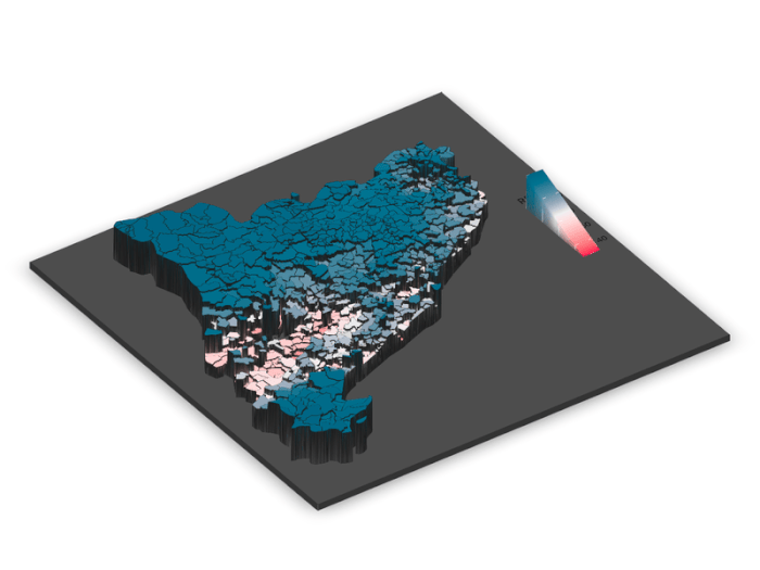
ForestDrought is a modeling platform developed by CREAF that, unlike other tools, models how meteorology interacts with soil and vegetation, a key factor in understanding phenomena such as drought, fire risk or the regulation of the water cycle. All thanks to the MEDFATE model , also developed by the Ecosystem Modeling Facility. Until now, it only operated at the Catalan scale and now offers information on all forests in Spain. The tool calculates daily soil water content and vegetation water stress based on data from the State Meteorological Agency (AEMET), the Meteorological Service of Catalonia (SMC), MeteoGalicia and the Agroclimatic Information Network of Andalusia (RIA), combined with soil, relief and forest structure information from the National Forest Inventory, the Forest Map of Spain and data derived from LiDAR flights. All of this allows us to estimate the drought stress of vegetation and the moisture of living fuel, two key variables for understanding the risk of forest fires.
On the other hand, the update of the Forestry Laboratory has also allowed another application that is also being expanded throughout Spain to be improved: Meteoland, an application that provides daily weather estimates continuously based on statistical interpolation tools. It offers the last 365 days, even in areas where there are no weather stations, of variables such as temperature, precipitation, relative humidity, wind, solar radiation and potential evapotranspiration. “Meteoland can be very useful in cases where it is necessary to consult climate data in areas where there is no direct information available; in addition, it allows you to consult its uncertainty. This includes cases such as scientific studies, but we have also had comments from users who use the information to predict in which areas there will be more mushrooms during the season”, says Víctor Granda.
YOU MAY ALSO BE INTERESTED IN
A sponge full to overflowing
The recent rains and episodes of levante have caused a very significant increase in the humidity of the forest soil in a large part of the territory. On the one hand, the visualizations of the Forest Laboratory show maximum results of soil humidity, which means that the water has infiltrated until it fills it, and on the other hand, very high results of blue water, which means that the water that is no longer absorbed slides downhill, emerges from the springs and streams towards the river or percolates until it fills underground aquifers. Let us remember that green water is that rainwater that is retained in the forest, both within the vegetation and underground, while blue water is that which flows from the springs and streams and reaches the rivers, wetlands, reservoirs and aquifers.
This recharge is key to forest resilience , as it can cushion the impact of future droughts and reduce fire risk in the short and medium term, provided that future weather conditions do not reverse this situation. It is also key to human resilience, as it replenishes reservoirs and aquifers that are then key to supplying the agricultural and industrial sectors in future droughts. However, highly waterlogged soil can also destabilize land and lead to landslides in high-slope areas such as slopes.

3D map showing the increase in soil moisture in Catalonia
"Having the soil full of water is insurance for the future. It allows us to know that in the face of future droughts we will have an essential water reservoir to maintain forests and river flows. However, the last time we achieved good amounts of water in the forest soil was during the Gloria in 2022, and we have already seen that heat waves and extreme droughts are capable of leaving us without water in a short time; we cannot let our guard down," says Annelies Broekman, a CREAF researcher who is an expert in water and global change.
After three years of drought, Catalonia has had to rain above the average of the last 20 years, in some cases 150% more, for the forest soil to replenish itself again to its maximum.
An example of the good water situation in Catalonia's soil is the Carme Capellades aquifer , a symbol of the drought of recent years with the image of its dry pond in front of the paper mill. Today, this pond is about to overflow, indicating that the aquifer is completely full.
YOU MAY ALSO BE INTERESTED IN
Open science at the service of society
The Forest Laboratory is an infrastructure 100% developed and maintained by CREAF, with funding from the Severo Ochoa program. In addition to the visualization tools, the data and models generated constitute a fundamental basis for scientific research and for the analysis of climate change on Mediterranean forests. Within the platform, users can visualize the data, but also download them and use them for their own experiments. In addition to these two apps, the Laboratory also has apps that allow you to follow the state of health of the forests of Catalonia (the Deboscat), data on specific forest measurements, such as allometry, or data from forest inventories, among others.